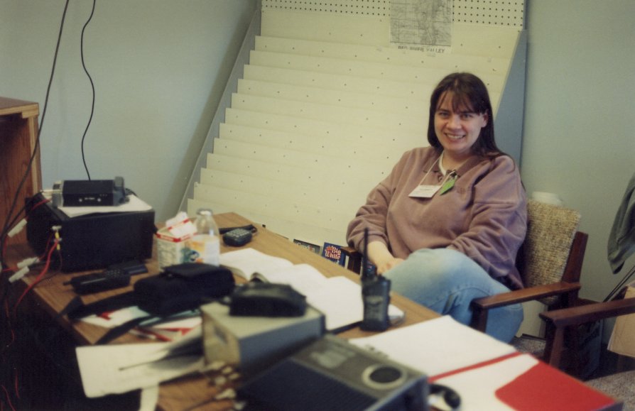
At first we worked out of the Town Hall in Morris then later moved to the hospital. Here is the ARES station run by Gordon Snarr VE4GLS and Paula Ehn VE4MHZ in the Town Hall. This was the 3rd day of ememrgency operations and the water was still rising.
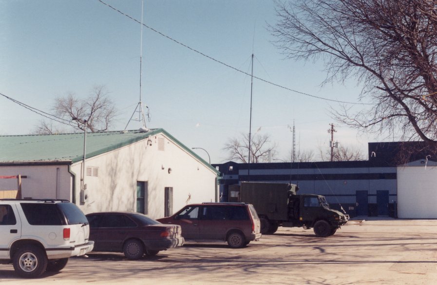
The Town Hall was also the Army radio base for the Municipality of Morris/McDonald until the water got too high and they moved out to Lowe Farm, MB. This is the back of the Town Hall with both ARES and army antennas shown. Roof of the MB Lotteries building (blue bulding in background) was our escape route should the dike breach.

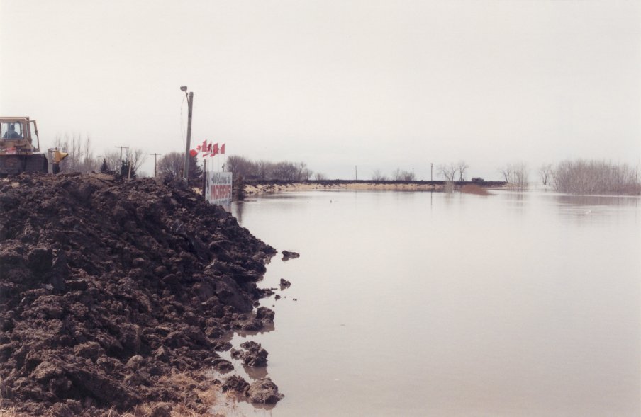
This is the picture of the inside of the dike closing off highway 75 at the north end of Morris. The water is within 3 feet of the top on the other side. Also you can see the top of the highway dividing sign poking through the dike with its yellow beacon still flashing despite being built into the dike. 3rd day of operation.

Hwy 75 bridge over the Morris River. Water is still rising and debris is caught on bridge railings will be gone at peak. In the background, you can see April's Drive-In and house belonging to the Town of Morris Mayor's mom. Both had to be torn down eventually. 3rd day of operation.
Welcome to Morris Sign on north end of town. Water is still rising here and will eventually reach half way up the red lettering on this sign at peak. 3rd day of operation.
Click here to see more pictures.
Last updated January 9, 2017